
If you are looking for an unforgettable hiking experience in Spain, the Rio Borosa Route in the stunning Sierra de Cazorla is a must-visit. This trail not only offers breathtaking views but also an opportunity to connect with nature in one of the most beautiful natural parks in the country. Get ready to dive into our detailed guide that will prepare you for this adventure, enriching your journey with insights and tips.
1. Overview of the Rio Borosa
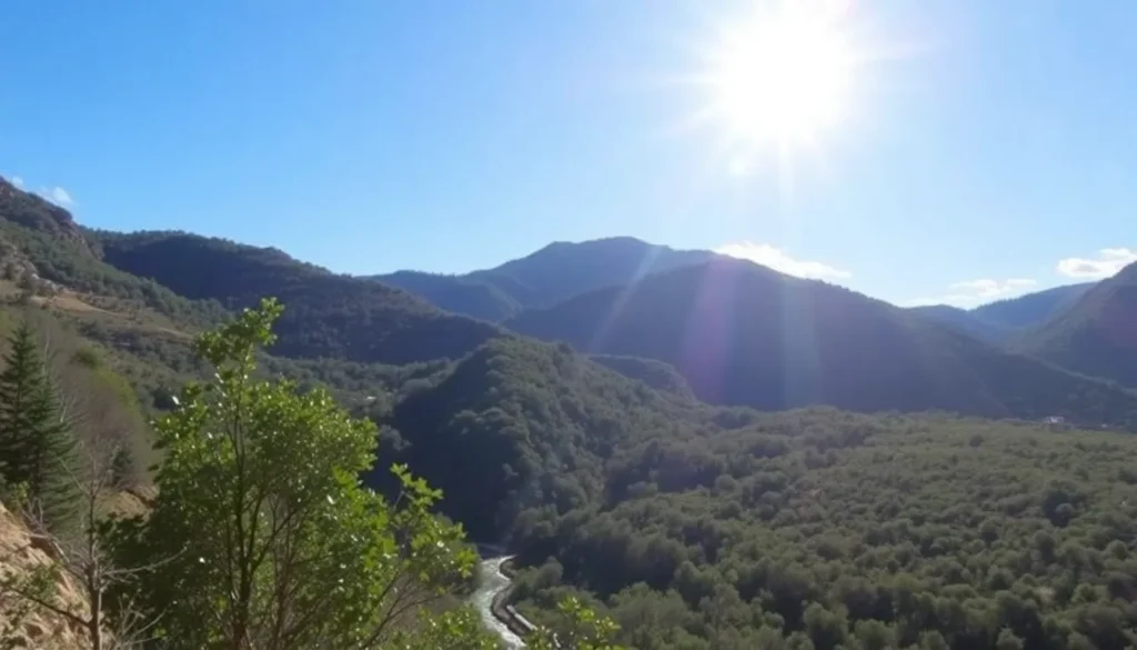
The Sierra de Cazorla is renowned for its diverse ecosystems and breathtaking landscapes, with the Guadalquivir River being its most famous waterway. However, the Rio Borosa, although smaller, is equally captivating. Spanning a mere 11 kilometers from its source to its confluence with the Guadalquivir, this river meanders through lush forests and breathtaking canyons, creating an oasis of tranquility.
The trail follows the Rio Borosa for approximately 11 kilometers, making it a perfect day hike. However, many visitors opt to hike just the first 4.5 kilometers to reach the iconic Cerrada de Elías, a series of wooden walkways hugging canyon walls that offer stunning views and a thrilling experience of walking above the river.
This section is often the highlight of the hike, showcasing the natural beauty of the park with crystal-clear pools, cascading waterfalls, and a variety of wildlife. Whether you choose to tackle the full route or the shorter version, the journey is sure to be memorable.
2. Getting to the Starting Point of the Rio Borosa Route
Most hikers begin their adventure in the charming town of Cazorla, which serves as a great base for exploring the surrounding area. To reach the trailhead, you will need to drive approximately 35 kilometers (about 50 minutes) along well-maintained roads that wind through beautiful forest scenery.
Your first stop should be the Torre del Vinagre Interpretation Center, where you can gather valuable information about the park's trails, flora, and fauna. Nearby, there’s a botanical garden featuring a giant sequoia, a rare sight in this region.
From here, a short detour leads you to the trailhead, with two parking areas available. The main parking lot is larger, but there is limited space at the beginning of the trail next to Mesón Los Monteros.
Additionally, the Centro de Visitantes Río Borosa is located between the two parking areas, providing expert advice and answering any last-minute questions you might have about the hike.
3. Trail Highlights and Features
As you lace up your boots and set off, you can look forward to a scenic journey filled with natural wonders. The first 3.2 kilometers of the route are along a gentle forest track, gradually ascending alongside the Rio Borosa. Along the way, you will cross the river multiple times over wooden bridges, providing picturesque views of the water below.
After crossing several bridges, you will arrive at a charming picnic area before the trail transitions into a narrower path through the shade of the forest. This part of the hike is delightful, with well-maintained trails and only minor obstacles to navigate.
In about an hour or so, you will reach the breathtaking Cerrada de Elías, where the wooden walkways provide stunning views of the canyon walls. This section is a photographer’s paradise, offering unique perspectives of the natural landscape.
As you continue past the walkways, the trail connects back to the original forest track leading to the Embalse de Aguas Negras. If you are feeling adventurous, you can continue to hike for another 11 kilometers to reach the dam, making for a total round trip of 22 kilometers.
4. Trail Map and Navigation
Before setting off, it’s essential to familiarize yourself with the route. A detailed map of the Rio Borosa trail can be a valuable tool. Not only will it help you navigate the trail, but it will also highlight key points of interest along the way. Here’s a handy map outlining the route and its attractions:
5. Tips for an Enjoyable Hike
To ensure your hike along the Rio Borosa is enjoyable and safe, consider the following tips:
- Stay Hydrated: Bring plenty of water, especially during warmer months. There are sources to refill at the trailhead, but it's wise to start with a full bottle.
- Plan for the Weather: The Sierra de Cazorla can get quite hot in summer, so start early to avoid the heat. Wear sunscreen and a hat for protection.
- Swimming Restrictions: While swimming is permitted in the first 100 meters of the river, be aware that it is prohibited beyond this point, so refrain from venturing into deeper waters.
- Observe Nature: Look out for unique plant species and local wildlife. The Pinguicula vallisneriifolia, a carnivorous plant, is one such example found along the trail.
- Use Online Resources: Make use of links to hiking resources for additional mapping options and trail information:
Packing the right gear can also make a significant difference in your experience. Consider wearing appropriate hiking shoes, bringing snacks for energy, and a camera to capture the stunning landscapes along the way.
As you prepare to explore the Sierra de Cazorla, remember that the Rio Borosa route is not just another hike; it’s a journey through one of Spain’s most beautiful natural settings. Each twist and turn of the trail reveals new marvels, and the tranquility of the area offers a perfect escape from the hustle and bustle of daily life. We hope you enjoy every moment of this adventure!
For an immersive preview of what to expect, check out this video showcasing the beauty of the Rio Borosa:
En este contexto, te invitamos a ver un video que explora en detalle el fascinante sendero del río Borosa en las montañas de Cazorla.


